The geodesic vertex viewer allows us to locate where the monoliths, built along the peninsula, are located, using the topographic maps, Opeen Street Map and the current aerial orthophoto. It also includes the reviews provided by ign, with situation mapping, coordinates, milestone data, in pdf format when clicking on them.
Geodesic vertices are monoliths built in high places with plenty of landscape visibility (peaks, hills, towers, etc.), from where it can be calculated by trigonometry of triangles with other vertices, the exact height of a point. In Spain there is a network with more than 11,000 milestones of this type (peninsula plus island territories), being one of the predominant elements in any orographic summit. The National Geographic Institute (IGN) is responsible for carrying out this geodesic study.
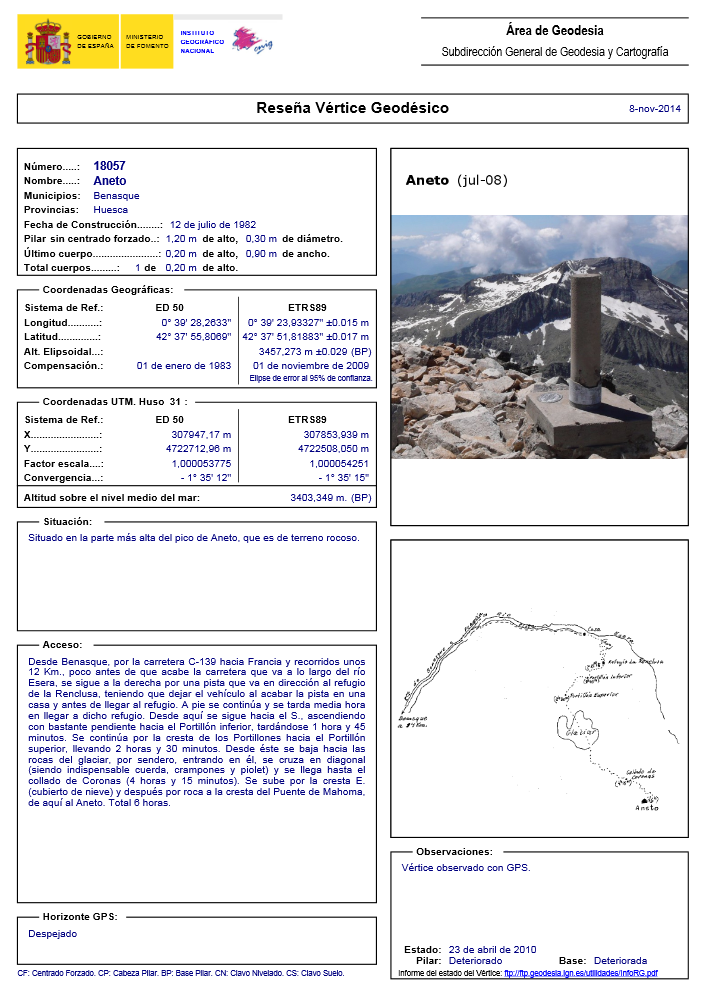
Example of a review of a Geodesic Vertex, in this case the Aneto. To locate more geodesic data of different milestones, IGN offers the following service: http://www.ign.es/ign/layoutIn/geodesiaVertices.do
More information about Geodesy in Spain:
http://www.ign.es/web/resources/docs/IGNCnig/GDS-Teoria-Geodesia.pdf